

Quick Answer: What Is China’s Grand Canal?
China’s Grand Canal (大运河, Dà Yùnhé) is a network of inland waterways built and changed across many centuries. The Sui linked earlier canals into a larger imperial system in the early seventh century. Later rulers altered the network to serve new capitals and transport needs.[1][2]
- Purpose: Canal transport moved grain and other supplies, and its management connected agricultural regions, cities and the court.[1][2]
- Engineering: Locks helped boats cross changes in water level, while diversions, reservoirs and embankments helped keep waterways usable.[1][2][3]
- Heritage: Selected waterways, waterworks, granaries and other sites form a UNESCO World Heritage property inscribed in 2014.[1][4]
The canal was a changing system of dug channels, natural waters and supporting facilities.[1][2]
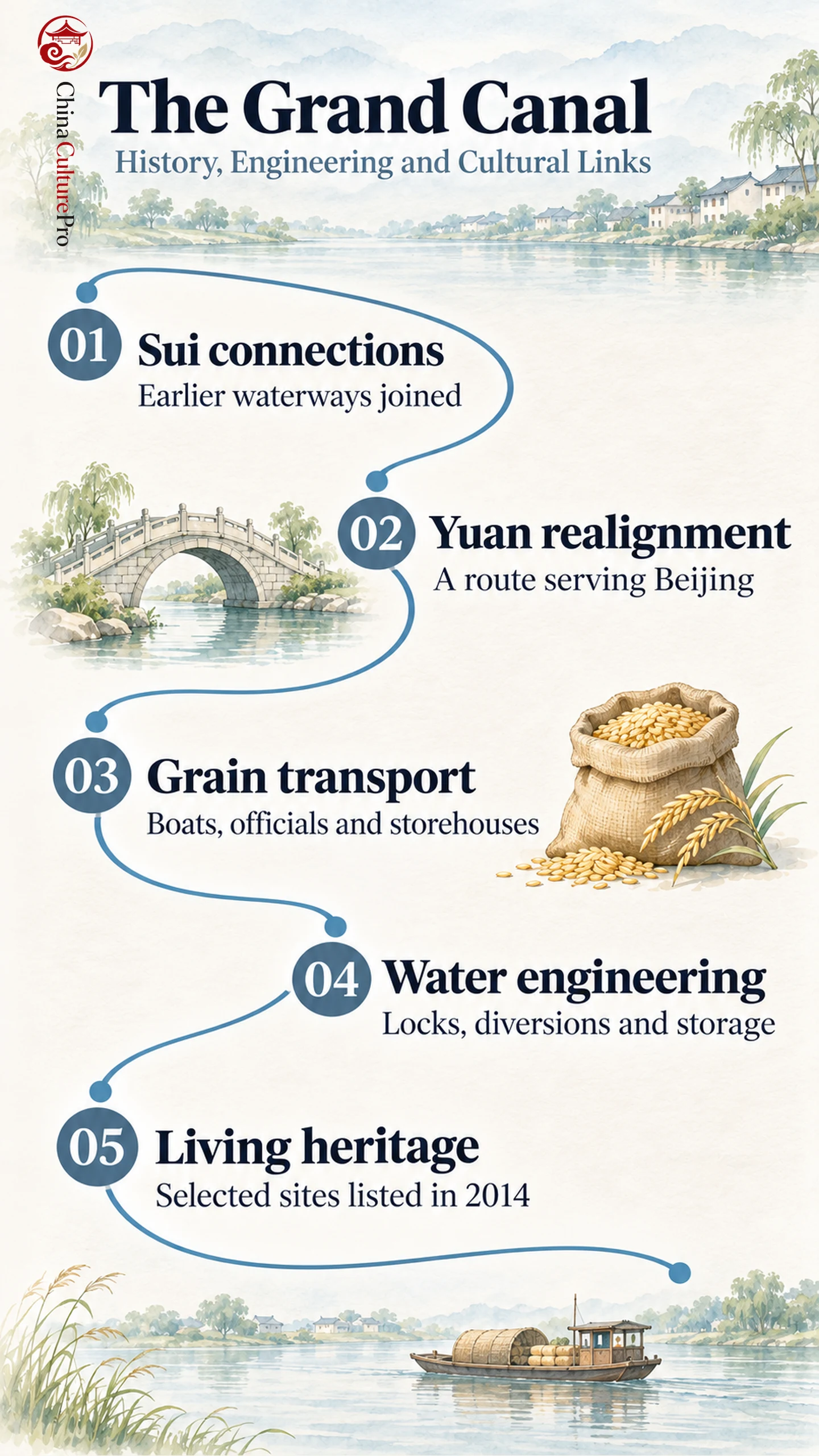
A grain boat approaching a change in water level needed a working lock and enough water to fill it. Its cargo also needed a place to be received and stored. Those requirements connected engineers, boat crews and grain officials along the Grand Canal. It connected work on the water with decisions about how to move and store food, a recurring problem in Chinese history.[1][2][3]
How the Canal Network Took Shape
Some stretches predated a unified Chinese empire. An early example is the Hangou (邗沟, Hángōu), associated with the state of Wu and used to connect the Yangtze and Huai river systems. The Sui dynasty linked and extended waterways on an imperial scale. Its network connected Luoyang (洛阳, Luòyáng) with major producing areas in the lower Yangtze region.[1][2]
The political geography changed when the Yuan dynasty made its capital at what is now Beijing. Late thirteenth-century work reorganized sections to serve a north–south route from Hangzhou toward the northern capital. The distinction between the Sui network centered on Luoyang and the later Beijing-oriented route helps explain why the canal has several historical alignments. These changes follow the shifting needs of China’s imperial capitals.[1][2]
How Grain and Supplies Moved North
The caoyun (漕运, cáoyùn) system organized official transport by water. Grain could move from producing areas to stores and distribution points that supplied the court, cities and troops. UNESCO describes a broader system of management and control that also concerned strategic goods, traffic and taxes. Boats moved supplies, while storehouses and officials helped manage when and where they could be issued. The traditional caoyun institution disappeared in the twentieth century, while some waterways continued to carry traffic.[1]
The sites of the Hanjia and Huiluo granaries at Luoyang are among the heritage components. They make storage visible as one part of the larger system. Grain had to be collected and held before it could serve as a regular supply. That connection links water transport to the history of Chinese agriculture and to the administration of food.[1][4]
How Engineers Managed Water Levels
A canal that joins river basins must deal with differences in elevation. A pound lock uses two gates around a chamber. Water entering or leaving the chamber raises or lowers a boat before it passes into the next stretch. An early two-gate lock described in the canal literature dates to 984 and is associated with Qiao Weiyue (乔维岳, Qiáo Wéiyuè), a Song transport official.[2]
Water supply presented a different problem. At Nanwang (南旺, Nánwàng) in Shandong, the canal crossed a high point. In the Ming, works begun in 1411 diverted water from the Wen River toward the canal. The Daicun Dam and an artificial channel directed water to Nanwang. Storage lakes and gates helped hold it and distribute it toward canal sections in both directions. The system shows how Chinese hydraulic engineering addressed conditions that changed from one stretch to another.[3]
The Yellow River posed another kind of problem. Floods and changes in its course could interrupt canals linked to it. The network needed repeated maintenance as river and canal conditions changed. An engineering solution at one site addressed the water available there and the risks of that particular connection.[1][2]
How the Canal Changed Cities and Cultural Life
Canal towns brought boat crews, merchants and local producers into contact. The waterways helped move everyday goods and linked wealthy commercial centers in the south to northern markets. Their influence extended into the places where cargo was sold, stored and transferred, part of the wider history of Chinese merchant culture.[1][2][5]
The Qing Southern Inspection Tour paintings record one way the canal entered court culture. The Kangxi Emperor commissioned scrolls commemorating his 1689 tour, with Wang Hui directing the painters. The series followed a journey that used the canal and passed through major southern centers. One scroll depicts the route from Wuxi to Suzhou, putting the waterway and the cities it connected inside a court-sponsored record. The paintings preserve an imperial view of these places and of how the court wanted the journey remembered.[5]
What the Heritage Listing Preserves
The UNESCO property brings together selected stretches and related structures, including waterworks and granaries. Some sections have been repaired or altered through later work. Others survive as archaeological remains. The listed sites preserve traces of a wider network. A granary site can document storage even after a nearby channel has shifted or ceased carrying the same cargo.[1][4]
FAQs About the Grand Canal
Did the Sui dynasty build the entire Grand Canal?
The Sui linked and extended earlier waterways as an imperial project. Later dynasties rebuilt sections and altered the routes, including the Yuan works serving the northern capital.
Why did the canal need locks and water diversion?
Locks let boats pass between stretches with different water levels. Diversions and reservoirs supplied or regulated water where it was needed along the network.
Is the historic Grand Canal still in use?
Some sections remain in use, while others survive as historic or archaeological sites. The UNESCO property includes working stretches and historical remains, including related structures on land.
出典
[1] UNESCO World Heritage Centre. The Grand Canal
[2] Yuan Wang. Management of the Grand Canal and Its Bid as a World Cultural Heritage Site
[3] China Grand Canal Museum. Canal Water Management: The Nanwang Waterworks
[4] UNESCO World Heritage Centre. The Grand Canal: Maps and Component Sites
[5] Columbia University, Asia for Educators. Recording the Grandeur of the Qing: The Southern Inspection Tour Scrolls