

Quick Answer: How Does Geography Shape Chinese Culture?
Chinese cultural geography studies how landscapes, movement and human institutions shape regional ways of life. Rivers connect settlements, mountains affect routes, and climate influences farming. These conditions matter alongside migration, trade, government and community choices.
- Place conditions: Water, terrain and growing seasons help explain where particular farming and building practices developed.
- Changing connections: Canals, passes and ports carry people, materials and ideas between regions.
- Human choices: Communities transform environments and maintain traditions through work, language, education and ritual.
A cultural region is therefore a historical relationship among places and people. Its boundaries need not match a province, river basin or language area, and geography does not prescribe anyone’s personality.
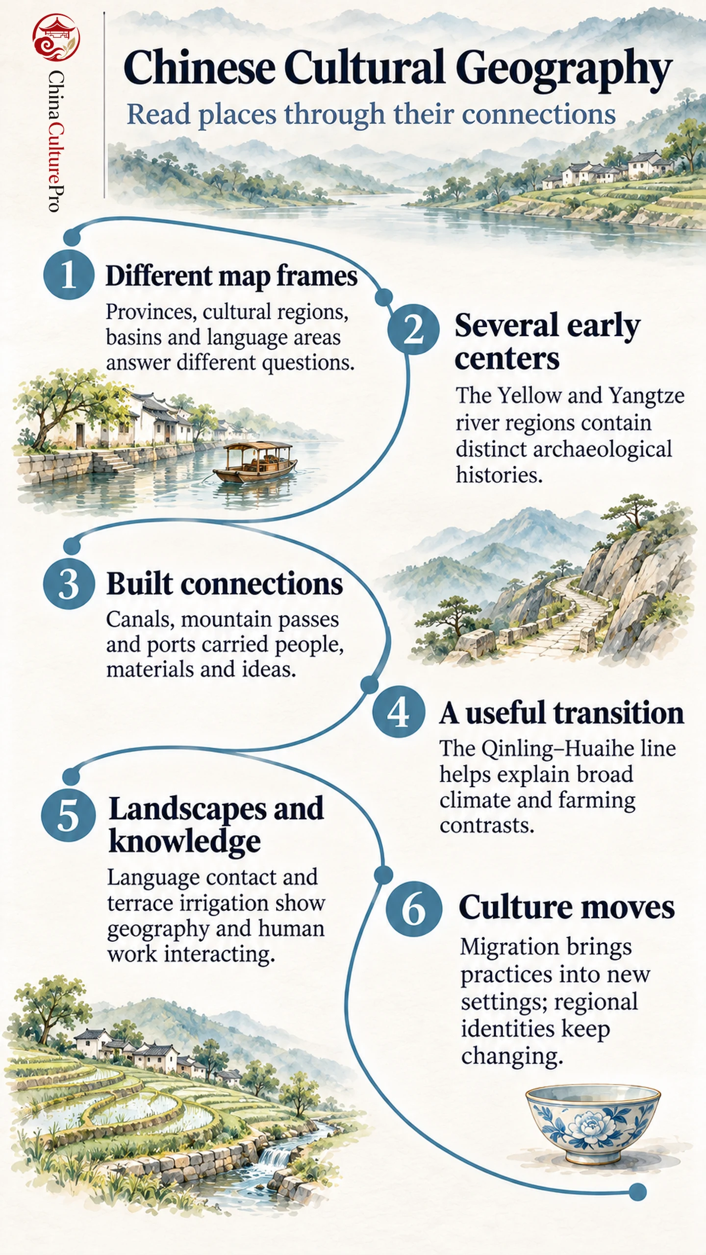
A provincial map, a river map and a language map can describe the same place differently. Reading them together makes Chinese regional culture easier to understand: landscapes create opportunities and difficulties, while people build the connections that give those places meaning.
Cultural Regions and Provinces Answer Different Questions
Before comparing regions, identify what each label measures. An administrative boundary, an area of shared speech and a historical trading network can overlap without describing the same thing. Each frame answers a useful question; trouble begins when one substitutes for another.
| Geographic frame | Qué permite comprender | What it cannot establish alone |
|---|---|---|
| River basin | Water drainage and connections among upstream and downstream places | A single shared language or cultural identity |
| Historical cultural region | Relationships built through settlement, commerce, institutions and memory | An unchanging boundary across every historical period |
| Province | Administrative organization within a particular period | Cultural uniformity among its residents |
| Language area | Distribution of particular speech features | An exact match with ancestry, ethnicity or provincial borders |
Consider Huizhou culture: its historical six-county setting includes Wuyuan, now in Jiangxi, alongside counties in present-day Anhui. Restricting the subject to modern Huangshan would change its historical scope. [4] When reading a regional label, asking “which places, during which period?” is often more useful than searching for one permanent outline.
River Basins Supported Several Cultural Centers
The Yellow River(黄河,Huáng Hé)and Yangtze(长江,Cháng Jiāng)connect extensive territories with different environments. Even one river passes through contrasting landscapes; treating its whole basin as a uniform culture conceals that variation. The Central Plains provide one important historical setting within a much wider geographical picture. [1]
Early cultural development also needs more than a single northern center. Liangzhu, in today’s Zhejiang, preserves evidence of a late Neolithic rice-growing society in the lower Yangtze region. Its settlement, water-management works and ritual jade objects show that organized social and ceremonial life developed there as well. [2]
This does not make every early community part of one identical tradition. Archaeological sites answer questions about particular populations and periods. Comparing them helps distinguish several centers of development from the later political and cultural connections among regions.
Canals, Passes and Ports Changed the Connections
Transport networks altered which places could exchange goods and sustain regular contact. The Grand Canal(大运河,Dà Yùnhé)joined waterways across river basins, making north–south movement possible on a scale that natural eastward-flowing rivers alone could not provide.
Its history extends across successive construction and management projects. Early sections preceded the Sui dynasty’s major integration in the seventh century; later development further connected northern and southern areas. Grain transport linked agricultural producers, warehouses, officials, boat crews and urban consumers. The canal consequently belongs to the history of institutions and labor as much as engineering. [3]
Ports connected inland production with overseas demand. Canton porcelain offers a compact example: ceramics made inland could be decorated in Guangzhou for export. Understanding the object requires both manufacturing and maritime connections, an important theme in Lingnan culture. [5]
Mountain routes likewise need to be considered alongside barriers. A ridge may make travel difficult, while a pass channels repeated contact through particular settlements. The relevant question is how movement worked in a given period, rather than whether a place was simply “isolated.”
What the North–South Divide Can Explain
The Qinling–Huaihe line(秦岭—淮河线,Qínlǐng–Huáihé xiàn)is a widely used geographical reference for differences between northern and southern China. It helps organize discussion of climate, water availability and agricultural patterns, including broad contrasts between dry-field farming and rice cultivation. [7]
The familiar association of northern food with wheat and southern food with rice is useful at that broad scale. It cannot describe every locality, household or meal. Farming patterns are themselves affected by irrigation and changing markets; food habits also travel.
A climate transition and a language boundary answer different questions. A town near this geographical line does not become culturally northern or southern in every respect at one exact crossing. Describe the feature being compared—crops, seasonal conditions, speech or cuisine—before applying the larger label. This keeps a convenient regional framework from turning into a rule about individuals.
Mountains, Languages and Local Knowledge
Mountains can reduce everyday contact across ridges, while river valleys and migration routes bring speakers together. Chinese dialect geography reflects these interacting processes. A computational study comparing pronunciation, vocabulary and grammar identifies relationships involving waterways, mountain ranges and historical migration. Its results concern patterns across speech communities; they do not imply that terrain determines the language of every resident. [6]
The broader landscape of Yunnan culture also requires attention to different languages, livelihoods and local histories. One province contains many kinds of connection, rather than one mountain culture.
People actively reshape these settings. The Honghe terraces associated with Hani communities combine rice fields with forests, villages and managed water. The landscape embodies accumulated knowledge and coordinated work, as well as environmental conditions. [8] A photograph of terraces shows their form; understanding their cultural significance also requires asking who maintains water channels and how that knowledge is passed on.
Migration Carries Culture Across Boundaries
Regional culture includes movement. Language features, commercial skills, family practices and religious traditions can acquire new settings as people migrate. Dialect research therefore examines historical contact alongside physical distance; similarity need not mean two communities occupied an unchanged cultural territory. [6]
In a regional study of Dongbei, for example, settlement and migration belong beside winter environments and industrial history. The same reading principle applies elsewhere: distinguish inherited local practices from those carried in, then consider how their relationship changed.
Regional identity is also different from an official ethnic category. The study of Chinese ethnic groups involves classification, historical relations and community identification. It cannot be reduced to a list of environments or costumes. [9]
For a useful cultural comparison, choose a specific practice, name its community and setting, and examine its connections. A temple network, market route or irrigation system reveals more than a claim that an entire region possesses one permanent character.
FAQs About Chinese Cultural Geography
Do Cultural Regions Match Provincial Borders?
Sometimes they overlap, but they serve different purposes. A province is an administrative unit; a historical cultural region may extend across several provinces or cover only part of one.
Is There One Exact North–South Cultural Border?
No single line separates every cultural feature. The Qinling–Huaihe reference is useful for physical geography, while language, food and historical identities have their own patterns.
Does Landscape Determine People’s Personalities?
No. Environmental conditions influence possibilities and constraints. They cannot establish an individual’s temperament, beliefs or abilities, which should never be inferred from a regional label.
Fuentes
[1] Robert W. McColl. Understanding the Geographies of China: An Assemblage of Pieces
[2] UNESCO World Heritage Centre. Archaeological Ruins of Liangzhu City
[3] UNESCO World Heritage Centre. The Grand Canal
[4] Academy of Chinese Studies. Huizhou Culture
[5] Guangzhou Museum. Canton Porcelain: A Fusion of Global Fashion
[6] He Huang, Jack Grieve, Lei Jiao and Zhuo Cai. Geographic structure of Chinese dialects: a computational dialectometric approach
[7] Sustainability. Study on the Spatial Differentiation of the Populations on Both Sides of the Qinling-Huaihe Line in China
[8] UNESCO World Heritage Centre. Cultural Landscape of Honghe Hani Rice Terraces
[9] Tamara Jacka, Andrew B. Kipnis and Sally Sargeson. Contemporary China: Ethnicity